
Understanding the Essentials of Land Surveying in Melbourne
What Exactly is Land Surveying and Why is it Important?
Land surveying is a critical discipline that involves the precise measurement and mapping of land to determine property boundaries, identify land features, and provide essential support for various construction projects. In the vibrant city of Melbourne, this practice plays a pivotal role in urban planning and development initiatives. As Melbourne’s population continues to grow and its real estate market becomes increasingly dynamic, the need for accurate land surveys has surged. Skilled land surveyors employ advanced techniques to ensure that property boundaries are established correctly, which in turn facilitates orderly development and optimises land utilisation. They deliver invaluable data for construction, infrastructure projects, and property transactions, ensuring compliance with local regulations and policies, thus safeguarding the interests of all parties involved.
What Are the Various Types of Land Surveys Conducted in Melbourne?
In Melbourne, a variety of land surveys are conducted to meet the diverse requirements of property owners, developers, and government agencies. The most prevalent types include boundary surveys, which clearly define property lines; topographic surveys that meticulously map the terrain’s features; and construction surveys that provide critical guidance for building projects. Boundary surveys are vital for establishing unequivocal ownership and preventing disputes among neighbours. Topographic surveys deliver essential information on elevations, contours, and land features, which are especially important for planning developments in hilly or irregular terrains. Furthermore, construction surveys ensure that projects are executed according to design specifications, thus maintaining the integrity of the development process and ensuring successful outcomes.
Why Are Accurate Land Surveys Crucial in Melbourne?
In Melbourne, the importance of accurate land surveys cannot be overstated, as they serve numerous fundamental purposes. They play a significant role in property transactions, assisting buyers and sellers in understanding exact boundaries and avoiding potential legal disputes that could arise from ambiguities. For developers, an accurate survey is essential for informing planning and design, ensuring that projects comply with zoning laws and construction codes. Moreover, accurate surveys can effectively resolve boundary disputes by providing clear evidence of ownership and identifying encroachments. In an urban environment like Melbourne, where properties are often closely situated, the precision of surveying is paramount. This accuracy not only ensures legal and financial security but also fosters trust in property dealings and development initiatives across the city.
What Role Do Land Surveyors Play in the Melbourne Landscape?
Land surveyors in Melbourne hold a pivotal position in ensuring accurate measurements and mapping, which are foundational for successful property development and urban planning projects. They undertake surveys that inform land use and construction strategies, acting as the essential link in the development process. Their expertise guarantees that developments adhere to legal standards, thereby avoiding costly errors stemming from incorrect boundary definitions. Additionally, land surveyors collaborate closely with architects, engineers, and local authorities, providing invaluable insights that help shape Melbourne’s future landscape. Their assessments influence various projects, from infrastructure developments to the preservation of heritage sites, thereby contributing significantly to the city’s urban fabric.
How is Technology Transforming Land Surveying in Melbourne?
The domain of modern land surveying in Melbourne is significantly enhanced by the adoption of advanced technologies that improve the accuracy and efficiency of data collection and mapping. Techniques such as Global Positioning System (GPS) technology enable surveyors to obtain precise location data, which is indispensable for establishing boundaries and performing topographic mapping. The use of drones is increasingly common for aerial surveys, allowing for the rapid capturing of high-resolution images and data over extensive areas in a cost-effective manner. Additionally, laser scanning technology provides detailed 3D models of the surveyed land, facilitating intricate analyses of structures and terrain features. These technological advancements are revolutionising the surveying industry, empowering Melbourne’s surveyors to deliver more reliable and comprehensive results than ever before.
How Does the Land Surveying Process Unfold in Melbourne?
What Tools and Equipment Are Essential for Surveyors?
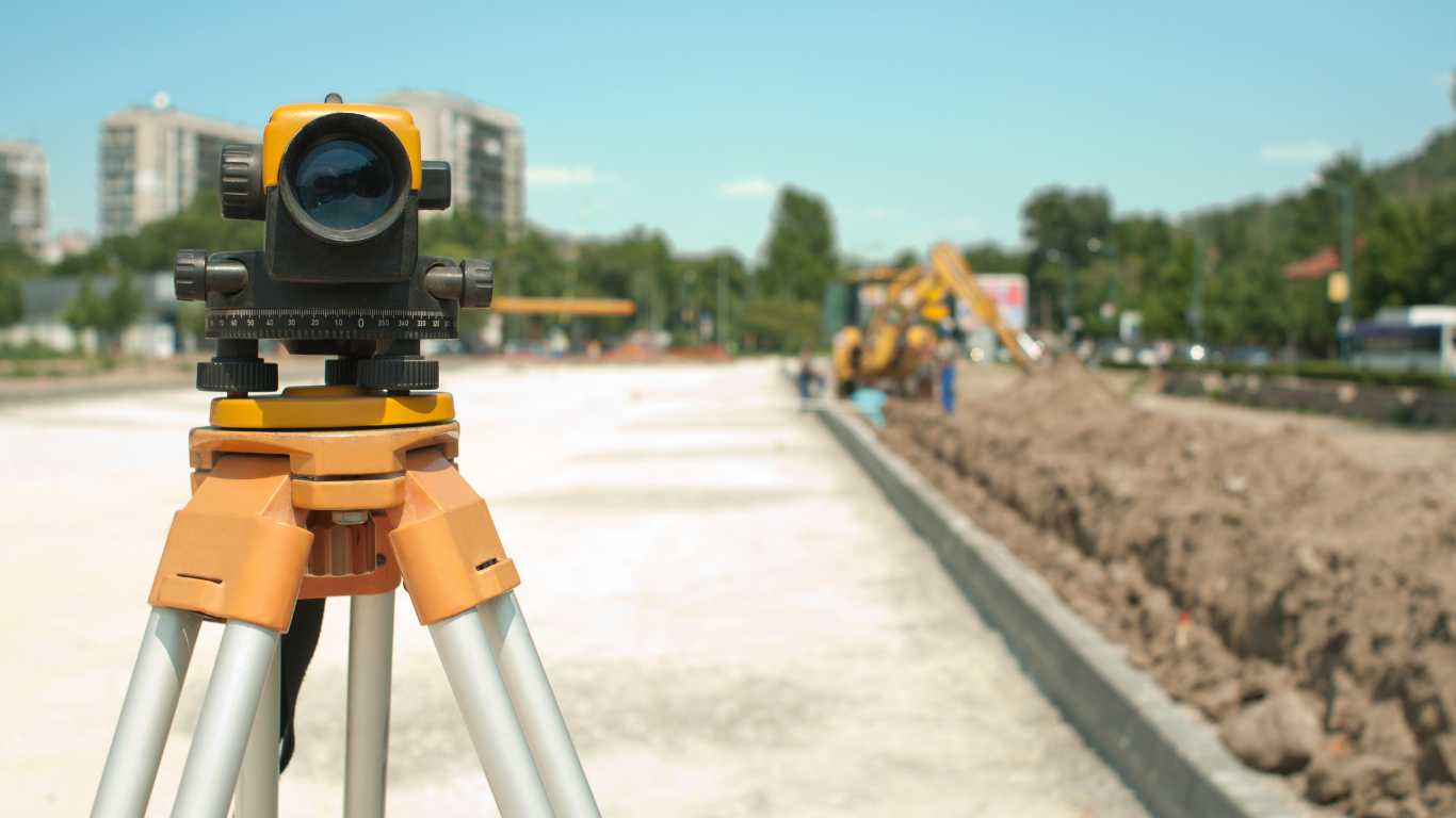
Surveyors in Melbourne utilise a diverse array of advanced tools and equipment to measure land accurately and efficiently. Among these, total stations are crucial for capturing precise angles and distances, enabling the detailed mapping of property boundaries. The advent of GPS technology has revolutionised the surveying process, allowing surveyors to determine exact locations with unparalleled accuracy. Moreover, drones equipped with high-resolution cameras are increasingly popular for surveying large areas, providing aerial perspectives that traditional methods simply cannot achieve. Additionally, cutting-edge software for data analysis and Geographic Information Systems (GIS) enables surveyors to create and manipulate detailed maps, facilitating comprehensive reporting and presentation of survey findings to clients.
What Are the Key Steps Involved in the Surveying Process?
The land surveying process in Melbourne comprises several critical steps designed to generate accurate and reliable survey results. Initially, surveyors engage in thorough planning, which involves reviewing existing documentation, assessing the site, and determining the specific type of survey required for the project. This planning phase is followed by fieldwork, where measurements are meticulously taken using the appropriate tools and technologies. Once data collection is complete, surveyors analyse the information, often employing advanced software to create detailed maps and comprehensive reports. The final step entails reporting findings to clients, typically consisting of visual representations of the data, precise boundary descriptions, and any identified encroachments or easements. Each of these steps is vital, as the integrity of the entire process hinges on the accuracy and quality of the data collected and analysed.
What Can Property Owners Expect During a Land Survey?
During a land survey in Melbourne, property owners can anticipate a range of tasks performed by the surveyor aimed at accurately marking boundaries and gathering essential data. The surveyor typically begins by reviewing any existing survey information related to the property, ensuring that all relevant data is taken into account. They will then proceed to mark the boundary lines using stakes or flags, followed by taking precise measurements of the land. In many instances, the surveyor may leverage drones or other advanced technologies to collect data efficiently, particularly for larger properties or complex sites. Throughout this process, the surveyor strives to minimise disruption to the property, ensuring that the survey is conducted with professionalism and respect for the property owner’s space.
Real-World Success Stories of Land Surveying in Melbourne
What Are Notable Examples of Successful Surveys in Melbourne?
Highlighting real-world examples of successful surveys in Melbourne emphasises the practical impact that accurate surveying can have on significant projects. For instance, the redevelopment of the former Melbourne Market site involved extensive surveys to delineate property boundaries and assess land features, ultimately facilitating a major urban renewal initiative. Another notable case is the resolution of boundary disputes for properties along the Yarra River, which required precise surveying to clearly delineate ownership and prevent encroachments from infringing on adjacent properties. Furthermore, the construction of critical infrastructure, such as the West Gate Tunnel, relied heavily on accurate surveys to ensure compliance with engineering specifications and navigate the complexities of an urban landscape. These examples illustrate how land surveys not only help resolve disputes but also pave the way for important developments that benefit the community.
- Redevelopment of the former Melbourne Market site.
- Boundary dispute resolution along the Yarra River.
- Construction of the West Gate Tunnel.
- Surveying for the Melbourne Metro rail project.
How Can Property Owners Choose the Right Surveyor in Melbourne?
Selecting a qualified land surveyor in Melbourne involves several key steps to ensure the chosen professional meets the project’s unique needs. First, verify the surveyor’s credentials and ensure they are licensed by the Surveyors Registration Board of Victoria, indicating that they have met the necessary educational and professional standards. Next, consider their experience, particularly in the type of survey required for your project. Reviewing client testimonials and online reviews can provide valuable insights into their reliability and quality of work. Lastly, request a detailed quote that outlines the services provided and any associated costs. This comprehensive approach will help secure a capable surveyor who can deliver accurate and professional results tailored to your specific requirements.
- Verify their licensing with the Surveyors Registration Board of Victoria.
- Assess their experience in relevant types of surveys.
- Read client testimonials and reviews for insights.
- Request a detailed quote outlining services and costs.
What Is the Future of Land Surveying in Melbourne?
The future of land surveying in Melbourne is poised for transformative changes driven by emerging technologies and evolving trends. Drones are becoming integral to surveying practices, allowing for rapid, high-resolution data collection across expansive areas without the need for extensive ground work. The incorporation of Artificial Intelligence (AI) into surveying software is also gaining momentum, facilitating predictive analytics that can enhance decision-making in urban planning and development. Additionally, advancements in 3D scanning and modelling techniques are set to improve the accuracy of capturing complex site features. As these technologies continue to evolve, land surveyors in Melbourne will be better equipped to provide even more accurate, efficient, and comprehensive services, shaping the future of urban development in this vibrant city.
Why Is Hiring a Land Surveyor Essential in Melbourne?
How Does Hiring a Surveyor Ensure Legal Compliance?
Engaging a land surveyor in Melbourne is essential for ensuring that property boundaries are legally compliant, thereby preventing disputes and facilitating smooth property transactions. Accurate surveys provide documented evidence of property lines, which is vital for establishing legal clarity in property ownership. This legal compliance protects property owners from future disputes with neighbours and ensures that any development or construction adheres to local zoning regulations. In a bustling city like Melbourne, where urban density can lead to complex property situations, the expertise of a qualified surveyor is indispensable. They guide property owners through legal requirements, ensuring that all aspects of land use comply with current laws and regulations, ultimately safeguarding their investments.
What Advantages Do Professional Surveys Provide for Development Projects?
Professional land surveys in Melbourne offer numerous advantages that are crucial for accurately planning and executing construction projects. These surveys supply detailed maps and data that inform the design and layout of structures, ensuring they fit within legal boundaries and adhere to environmental considerations. Moreover, professional surveys significantly reduce the risk of costly errors during construction, as they incorporate essential information on land features, elevations, and existing infrastructure. This level of detail is not only beneficial for compliance purposes but also for optimising land use, enhancing the overall quality of development projects across Melbourne, and thereby ensuring that they contribute positively to the urban landscape.
How Can Accurate Land Surveys Enhance Property Value?
Accurate land surveys can substantially enhance the value of your property in Melbourne. By providing clear and documented boundaries, they help avoid disputes that may deter potential buyers, thereby increasing buyer confidence. A well-defined property line not only boosts the attractiveness of the property on the market but also positions it as a lower-risk investment for buyers. Furthermore, resolving any encroachments or uncertainties through a thorough land survey adds to the overall appeal of the property, ensuring both legal and financial security in its valuation. In a competitive property market, the assurance of clarity provided by a professional survey can lead to higher selling prices and a more successful transaction.
How Do Surveyors Facilitate Future Development Opportunities?
A land surveyor in Melbourne can identify potential development opportunities on your property, aiding in future planning and maximising land use. With a comprehensive understanding of property boundaries and land features, surveyors can recommend optimal designs or modifications that align with local regulations and zoning laws. They assist developers in recognising the best use of land, which can lead to innovative solutions for residential, commercial, or mixed-use developments. By providing insights into both the potential and limitations of land, surveyors play a crucial role in guiding future developments, thus contributing significantly to the evolution of Melbourne’s urban landscape.
Essential Strategies for Engaging a Land Surveyor in Melbourne
How to Prepare Effectively for a Land Survey?
Before a land survey in Melbourne, proper preparation can significantly streamline the process. Property owners should endeavour to clear their property of obstacles that may hinder surveying activities, such as debris, landscaping features, or temporary structures. Providing any existing survey data or documentation to the surveyor can greatly enhance the accuracy of the survey, as it gives crucial context to the area being surveyed. Furthermore, clear communication with the surveyor regarding specific needs or concerns will ensure that the survey meets the property owner’s expectations. This proactive approach not only facilitates a smooth surveying process but also maximises the utility of the survey results, leading to more effective outcomes for all involved.
What Key Elements Should Be Included in a Survey Report?
A comprehensive survey report in Melbourne should encompass several key elements to ensure it meets the needs of property owners or developers effectively. The report should feature detailed maps that clearly depict property boundaries along with any relevant topographic information. Boundary descriptions are critical, providing legal definitions of the property lines as per the survey findings. Additionally, the report should document any encroachments or easements that may affect the property, offering invaluable insights for future planning and development. A well-structured report serves as a foundational document for legal purposes and can guide critical development decisions, making it a vital component of the overall surveying process.
How Can Property Owners Maintain Survey Accuracy Over Time?
To maintain the accuracy of land surveys in Melbourne, periodic re-surveys are advisable, especially before significant property changes or transactions. Factors such as land development, environmental alterations, or shifts in property usage can influence the relevance of previous survey data. It is recommended that property owners consider conducting re-surveys every few years or whenever substantial modifications are made to ensure that boundaries and property features are accurately represented. Regular updates not only ensure compliance with current laws but also protect property values by providing up-to-date information for potential buyers or investors, thereby fostering trust in the property’s legal standing.
What to Consider When Choosing the Right Land Surveyor in Melbourne?
Selecting the right land surveyor in Melbourne is crucial to ensuring that your land survey is conducted with professionalism and accuracy. Begin by looking for surveyors who possess local experience and an in-depth understanding of the specific regulations and conditions in Melbourne. Verify their licensing status and check for positive reviews from previous clients to gauge their reputation and reliability. Additionally, consider the surveyor’s expertise in the specific type of survey you require, whether it’s a boundary, topographic, or construction survey. Engaging a surveyor who understands the nuances of Melbourne’s unique landscape and regulatory environment will significantly contribute to the success and compliance of your project, ensuring that all necessary standards are met.
Understanding Land Surveying Regulations in Melbourne
What Local Laws and Regulations Govern Land Surveying?
Land surveyors in Melbourne must adhere to a comprehensive set of local laws and regulations to ensure their work is legally compliant and meets professional standards. The Surveying and Spatial Information Act outlines the responsibilities and standards required of surveyors in Victoria. These regulations are designed to protect property owners and ensure that surveys are conducted according to the highest professional standards. By adhering to these laws, surveyors help maintain the integrity of property rights and facilitate effective urban planning. Understanding these regulations is crucial for both surveyors and property owners, as they influence every aspect of land development and usage within Melbourne’s dynamic environment.
What Are the Licensing Requirements for Surveyors in Melbourne?
Surveyors in Melbourne are required to obtain a license from the Surveyors Registration Board of Victoria, ensuring they have met the necessary standards regarding education and experience. This licensing process is essential to uphold high professional standards in the industry, as it guarantees that surveyors possess the technical skills and knowledge required to conduct accurate surveys. Additionally, licensed surveyors are accountable to a regulatory body, which helps maintain the integrity of their work. Property owners should always verify a surveyor’s licensing status before engaging their services, as this is a key indicator of their professionalism and expertise in the field.
How Can Property Owners Verify a Surveyor’s Credentials?
To verify a surveyor’s credentials in Melbourne, property owners should check their registration status with the Surveyors Registration Board of Victoria. This registration confirms that the surveyor is legally recognised and qualified to perform surveying tasks in the state. Furthermore, property owners can look for professional memberships and certifications that showcase the surveyor’s commitment to ongoing education and adherence to industry standards. Engaging a surveyor with verified credentials not only ensures compliance with local regulations but also enhances trust in the accuracy and reliability of the survey results, providing peace of mind for property owners.
Where Can Property Owners Find Updated Surveying Regulations?
For the latest updates on land surveying regulations in Melbourne, property owners and surveyors should regularly check the Victorian Government’s website, which provides comprehensive information on legal requirements and standards. The Surveying and Spatial Information Act serves as a key resource for understanding current surveying laws and practices. By consistently reviewing these resources, both surveyors and property owners can remain informed about evolving regulations and compliance requirements. Staying updated is essential for navigating the complexities of land surveying in Melbourne’s dynamic urban landscape, ensuring that all activities align with current laws.
Frequently Asked Questions About Land Surveying
What is the primary role of a land surveyor?
A land surveyor measures and maps land to establish property boundaries, assess land features, and provide essential data for various construction and urban planning projects.
How do land surveys impact property transactions?
Land surveys provide clear documentation of property boundaries, preventing disputes and ensuring legal compliance. This clarity increases buyer confidence during real estate transactions, facilitating smoother dealings.
What types of surveys are commonly conducted in Melbourne?
Common types of surveys in Melbourne include boundary surveys, topographic surveys, and construction surveys, each serving distinct purposes in land development and planning processes.
How should I prepare for a land survey?
To prepare for a land survey, clear your property of obstacles, provide any existing survey data, and communicate your needs clearly to the surveyor to ensure a smooth surveying process.
Why are accurate land surveys essential for property owners?
Accurate land surveys are crucial for preventing disputes, ensuring legal compliance, and providing essential data for effective planning and development in Melbourne’s complex property landscape.
What technologies are currently used in modern land surveying?
Modern land surveying employs technologies such as GPS, drones, laser scanning, and advanced software for data analysis, significantly enhancing both accuracy and efficiency in the surveying process.
How often should I consider obtaining a land survey?
Periodic re-surveys are recommended, especially before major property changes, to ensure that boundaries and land features remain accurately represented and compliant with current regulations.
What should I look for in a survey report?
A good survey report should include detailed maps, boundary descriptions, and documentation of any encroachments or easements affecting the property, serving as a vital reference for future planning.
What are the licensing requirements for surveyors in Melbourne?
Surveyors must be licensed by the Surveyors Registration Board of Victoria, ensuring they meet professional standards in education and experience before providing surveying services.
How can I find a qualified land surveyor in Melbourne?
To find a qualified land surveyor, look for licensed professionals with local experience, positive client reviews, and expertise in the specific type of survey required for your project.
Connect with us on Facebook for more insights!


Land Surveyor Services
Get A Free Quote
Contact us today for a free, no-obligation quote on your Surveying Needs