
Comprehensive Overview of Detail Surveys in Tarneit
What Are Detail Surveys and Their Purpose?
Detail surveys represent a meticulous collection of measurements pertaining to land, structures, and environmental features that yield invaluable data essential for effective planning and development. These extensive surveys equip various stakeholders, such as developers, architects, and urban planners, with critical insights necessary for successful construction projects. Key elements involved in a detail survey encompass:
- Topographic mapping
- Boundary identification
- Identification of existing structures
- Utility locations
- Contour data
- Vegetation mapping
- Site dimensions
- Elevation data
Each of these components is indispensable, ensuring the information collected is not only precise but also highly relevant to the specific projects undertaken in the area.

Discover the Advantages of Detail Surveys in Tarneit
In Tarneit, a suburb in Melbourne experiencing rapid growth, detail surveys play a pivotal role in enhancing the precision of development projects. By delivering comprehensive information about the land and its current conditions, these surveys significantly mitigate risks associated with the planning and construction phases. Moreover, they facilitate informed decision-making, enabling developers and planners to craft projects that harmonise with the unique characteristics of the local environment. The precision achieved through detail surveys results in fewer revisions and construction delays, optimising resource utilisation and ultimately fostering the economic vitality of the region.
How to Effectively Prepare for a Detail Survey
Preparation for a detail survey is essential for ensuring a seamless and efficient process. Start by gathering all relevant property documents, ensuring clear access to the land, and coordinating with experienced surveyors well ahead of time. Key documents necessary for a successful detail survey include:
- Title deeds
- Previous survey reports
- Planning permits
- Site plans
- Utility maps
- Environmental assessments
- Any existing development plans
- Access agreements
Having these documents prepared in advance streamlines communication with the surveyor, ensuring an accurate and efficient survey outcome.
Guidelines for Selecting a Detail Survey Provider in Tarneit
Choosing a reliable surveyor in Tarneit is crucial for obtaining quality results that adhere to local standards and regulations. When selecting a detail survey provider, it is essential to consider their level of experience in the field, the technology they employ, and feedback from previous clients. A surveyor with a strong track record in Tarneit will possess not only the technical expertise required but also valuable insights into local regulations and conditions that could impact your project. Partnering with a reputable provider can save both time and money, ultimately leading to a more successful surveying experience.
Expert Opinions on Detail Surveys in Tarneit
What Characteristics Make Tarneit Ideal for Detail Surveys?
Tarneit’s rapid urbanisation and diverse land uses create a distinctive landscape for conducting detail surveys. The region is witnessing significant growth, with numerous residential, commercial, and industrial projects taking shape. This dynamic environment necessitates tailored survey approaches that factor in various elements, including zoning laws, environmental considerations, and infrastructure planning. For instance, a recent detail survey carried out for a new housing development in Tarneit involved extensive topographic mapping, ensuring compliance with local regulations while maximising the effective use of available land.
How Do Professionals Conduct Detail Surveys in Tarneit?
Professionals in the field employ cutting-edge technology and their local expertise to guarantee the accuracy and compliance of detail surveys in Tarneit. The process typically commences with a thorough site assessment aimed at identifying key features and potential challenges. Surveyors then utilise advanced tools, such as GPS and total stations, to obtain precise measurements. Conducting a detail survey can be outlined in several actionable steps:
- Initial site visit and assessment
- Preparation of a detailed survey plan
- Utilisation of appropriate technology for data collection
- Data analysis and comprehensive report preparation
- Client consultation to discuss findings
These steps ensure that the survey outcomes align with the specific requirements of the project while conforming to Australian standards.
What Are the Latest Innovations in Detail Surveys?
The domain of detail surveys is currently undergoing numerous innovations, with advancements like drone surveys and 3D modelling transforming traditional methodologies. These cutting-edge technologies enhance efficiency by enabling surveyors to capture extensive datasets quickly and accurately. Drones, in particular, offer aerial perspectives that can uncover information not easily visible from the ground. Expert analyses indicate that these trends are not only enhancing the detail and speed of surveys but also reducing costs for developers and planners. As these technologies continue to progress, they are likely to further elevate the capabilities of detail surveys in Tarneit and elsewhere.
What Challenges Do Surveyors Encounter in Tarneit?
Surveyors working in Tarneit face various challenges, particularly due to the area’s rapid urban growth and ongoing infrastructure projects. Issues such as restricted access to sites, evolving regulations, and the necessity for coordination with multiple stakeholders can complicate the survey process. Additionally, the presence of existing structures and utility lines may create obstacles when it comes to accurately gathering data. To address these challenges, experts recommend thorough planning and open communication with all parties involved. Employing advanced technologies and methodologies also plays a critical role in successfully navigating the complexities of modern surveying tasks in Tarneit.
Versatile Applications of Detail Surveys in Tarneit
What Are the Primary Uses of Detail Surveys in Tarneit?
Detail surveys serve a crucial function across various applications in Tarneit, particularly within the realms of land development and infrastructure projects. Common uses of detail surveys encompass:
- Site analysis for new developments
- Infrastructure planning and management
- Property subdivision
- Environmental impact assessments
- Utility mapping for service connections
- Site remediation planning
- Land use planning and zoning compliance
- Urban renewal initiatives
These applications underscore the significance of detail surveys in enabling informed decisions that foster sustainable development and community growth.
How Do Detail Surveys Enhance Urban Planning Efforts?
Detail surveys provide essential data that underpins urban planning, assisting in the design of sustainable and efficient communities within Tarneit. By offering comprehensive insights into land use, existing infrastructure, and environmental conditions, these surveys empower planners to devise well-informed strategies for growth. For instance, detailed topographic data can identify suitable locations for parks, residential developments, or commercial centres, ensuring a balanced urban environment that caters to community needs. Integrating detail survey data into the urban planning process encourages the creation of functional and visually appealing spaces for residents.
Utilising Detail Surveys for Environmental Management
Environmental management represents another critical area where detail surveys provide substantial benefits. In Tarneit, these surveys aid in assessing and managing environmental impacts during various development projects. By mapping existing vegetation, wetlands, and other natural features, surveyors offer vital data that informs decision-making concerning conservation efforts and sustainable land use practices. They also help in identifying potential hazards, such as flooding or soil erosion, thereby enabling developers to implement effective management strategies. Consequently, detail surveys contribute to responsible development that prioritises environmental integrity while accommodating necessary growth.
Understanding the Legal Framework for Detail Surveys in Tarneit
What Legislation Regulates Detail Surveys in Tarneit?
Detail surveys in Tarneit must comply with an array of legal frameworks, including the Surveying Act 2004 and local council regulations. These laws establish standards for surveying practices, ensuring accuracy, safety, and adherence to zoning and land use requirements. Compliance with these legal guidelines is essential for surveyors, as it safeguards the interests of property owners and developers while promoting responsible land use. A comprehensive understanding of these regulations equips surveyors to navigate the intricacies of the development process in Tarneit effectively.
How Can Stakeholders Ensure Compliance with Survey Regulations?
Ensuring compliance with survey regulations necessitates collaboration with certified surveyors and strict adherence to all relevant laws and standards in Tarneit. Property owners should engage surveyors with a strong reputation for compliance, as they possess the necessary knowledge and skills to navigate the regulatory landscape effectively. Additionally, regular training and updates regarding legislative changes are crucial for surveyors to maintain compliance in their practices. By prioritising adherence to regulations, stakeholders can mitigate risks associated with non-compliance, such as project delays and financial penalties.
What Are the Consequences of Violating Survey Regulations?
Violations of survey regulations can lead to significant repercussions, including project delays, financial penalties, and potential legal action in Tarneit. Non-compliance may result in the invalidation of a survey, necessitating costly reworks or disputes with local authorities. In extreme cases, developers might face litigation from affected parties arising from non-compliance issues. To avoid these serious consequences, it is imperative for all stakeholders to understand their responsibilities and engage qualified professionals capable of ensuring adherence to relevant survey regulations.
Technological Innovations and Tools in Detail Surveys in Tarneit
What Technologies Are Integral to Detail Surveys?
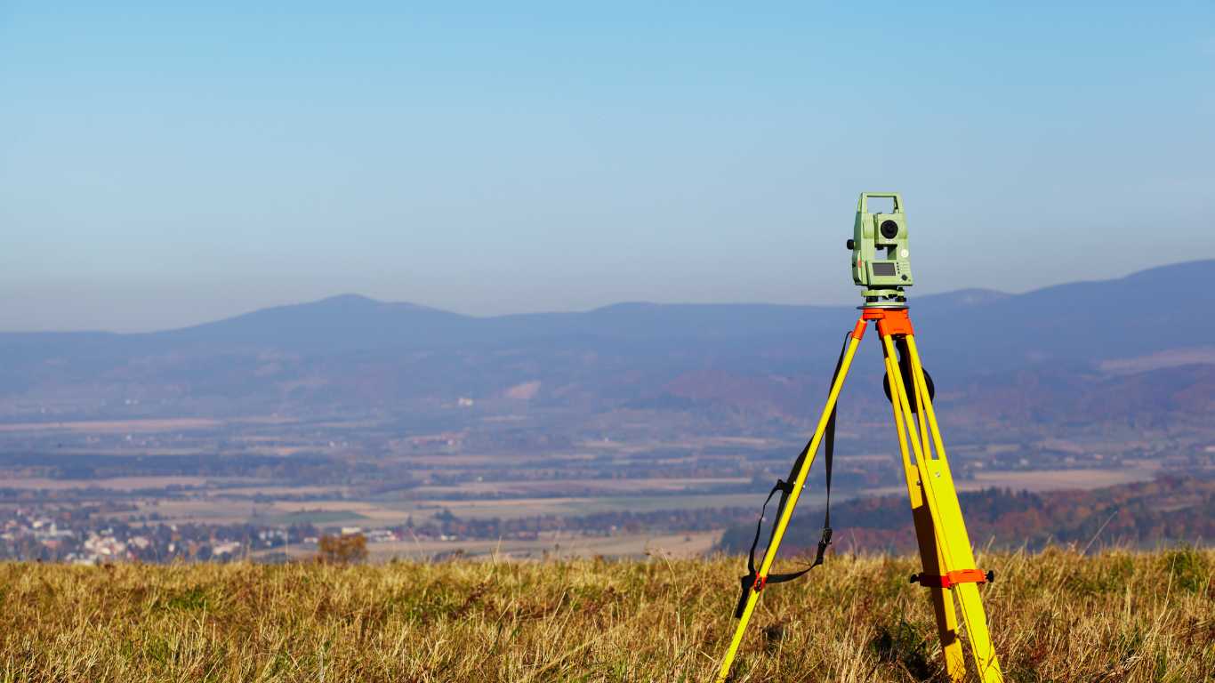
Technologies such as GPS, total stations, and drones are vital for conducting accurate detail surveys in Tarneit. GPS technology facilitates precise location data acquisition, while total stations blend electronic distance measuring with angle measurements to generate accurate coordinates. Drones have emerged as a revolutionary tool, empowering surveyors to efficiently capture large areas while providing high-resolution imagery and data that were previously challenging to obtain. The integration of these technologies not only enhances the precision of detail surveys but also streamlines the overall efficiency of the surveying process.
How Have Surveying Tools Progressed Over Time?
The transition from manual to digital tools has significantly improved both precision and efficiency in detail surveys across Tarneit. Historically, surveyors relied on traditional instruments like theodolites and measuring tapes, which demanded considerable time and effort. The advent of digital tools and software has transformed the industry, enabling advanced data analysis and visualisation. Modern surveyors can now employ software to process data collected from diverse sources, resulting in more informative and accessible survey reports. This evolution exemplifies the ongoing push towards increased accuracy and efficiency within the surveying profession.
How to Select the Appropriate Tools for Your Detail Survey
Choosing the right tools for a detail survey is contingent upon the survey’s scope, terrain, and desired outcomes in Tarneit. Important factors to consider include the size of the area being surveyed, the complexity of the features involved, and the level of accuracy required. For example, if surveying an expansive area with varied topography, drones may prove to be the optimal choice for data collection. Conversely, for smaller sites with intricate details, a total station may deliver the necessary precision. Understanding the specific needs of a project allows surveyors to select the tools that will yield the best results.
Research-Backed Advantages of Detail Surveys in Tarneit
How Do Detail Surveys Enhance Project Outcomes?
Detail surveys contribute to improved project planning, reduced errors, and increased property values in Tarneit. For example, a housing development that utilised a comprehensive detail survey reported a 20% reduction in construction delays compared to similar projects that did not conduct thorough surveys. Such improved outcomes underscore the vital role that detailed data plays in informed decision-making, enabling developers to optimise their plans and resources effectively. Consequently, the overall success of development projects is enhanced, benefiting both developers and the wider community.
What Economic Advantages Are Associated with Detail Surveys?
Detail surveys significantly bolster economic growth by facilitating efficient land use and development in Tarneit. By providing accurate data, these surveys help developers avoid costly mistakes, streamline project timelines, and ensure compliance with regulations. For instance, the successful alignment of commercial developments with local zoning laws, supported by detail surveys, can elevate property values and invigorate local economies. Moreover, the efficiencies gained from accurate surveying can lead to diminished construction costs, ultimately benefiting the end consumer and the broader community.
How Do Detail Surveys Promote Safety?
Detail surveys play an essential role in identifying potential hazards, thereby enhancing safety in development and construction practices within Tarneit. By mapping features such as drainage patterns, soil types, and existing utilities, surveyors can pinpoint risks that may affect construction activities. For instance, understanding the terrain and potential water flow can avert flooding and associated damages during and after construction. This proactive approach not only enhances on-site safety but also contributes to the longevity and sustainability of developments, benefitting the surrounding community at large.
How Do Detail Surveys Encourage Sustainable Development Practices?
Detail surveys in Tarneit advocate for sustainable land use and environmental conservation, contributing to long-term community planning and development. The data collected through these surveys informs strategies that strike a balance between growth and environmental considerations. For instance, recognising and preserving green spaces during the planning phases can result in healthier urban environments. Furthermore, sustainable practices encouraged by meticulous detail surveys can minimise the ecological footprint of developments, fostering a culture of responsible growth that benefits both current and future residents.
Looking Ahead: The Future of Detail Surveys in Tarneit
What Innovations Can We Anticipate in Detail Surveys?
Future innovations in detail surveys are likely to encompass the integration of AI and real-time data processing capabilities. As technology evolves, the ability to swiftly analyse and interpret survey data will enhance decision-making processes for developers and planners. AI can facilitate predictive modelling, enabling surveyors to forecast project outcomes based on historical data. These advancements promise to increase the accuracy of surveys while streamlining workflows, rendering detail surveys even more vital for future developments in Tarneit.
How Will Detail Surveys Adapt to Tarneit’s Ongoing Growth?
As Tarneit continues to expand, detail surveys will adapt to meet the growing demands of increased development and urbanisation. Adaptations may involve the incorporation of more advanced technologies and methodologies to keep pace with the changing landscape. For example, integrating 3D visualisation tools could assist stakeholders in comprehending complex projects better, enhancing collaboration among developers, planners, and the community. This evolution will ensure that detail surveys remain pertinent and effective in supporting responsible development practices in the future.
What Role Will Detail Surveys Play in Future Sustainable Development Initiatives?
Detail surveys will be instrumental in planning for sustainable development, balancing growth with environmental considerations in Tarneit. As urban areas expand, careful planning that accounts for ecological impacts will become increasingly critical. Detail surveys will provide the foundational data necessary to support initiatives focusing on green building practices, efficient resource use, and the preservation of natural habitats. By facilitating a balance between development and conservation, detail surveys will be crucial in shaping a sustainable future for Tarneit.
Frequently Asked Questions
What defines a detail survey?
A detail survey is a thorough measurement of land, structures, and features that provides essential data for planning and development processes.
Why are detail surveys vital in Tarneit?
Detail surveys are essential in Tarneit as they enhance development accuracy, reduce associated risks, and support informed decision-making in a rapidly growing locale.
What preparations are necessary for a detail survey?
Preparing for a detail survey entails gathering property documents, ensuring land access is clear, and coordinating effectively with surveyors.
How do I select a suitable detail survey provider?
Selecting a detail survey provider involves evaluating their experience, the technologies they utilise, and client feedback to ensure quality and compliance with local standards.
What are the prevalent applications of detail surveys?
Common applications of detail surveys in Tarneit include land development, infrastructure planning, environmental assessments, and property subdivisions.
What technologies are utilised in detail surveys?
Technologies such as GPS, total stations, and drones are fundamental for conducting accurate detail surveys in Tarneit.
How do detail surveys improve safety in construction?
Detail surveys assist in identifying potential hazards and informing safer development practices by mapping terrain, drainage patterns, and existing utilities.
What legal requirements govern detail surveys in Tarneit?
Detail surveys in Tarneit must comply with the Surveying Act 2004 and local council regulations to ensure accuracy and safety throughout the surveying process.
What are the implications of violating survey regulations?
Violating survey regulations can result in project delays, financial penalties, and legal repercussions, emphasising the importance of compliance for stakeholders.
How do detail surveys facilitate sustainable development?
Detail surveys promote sustainable land use and conservation, assisting in responsible planning and development practices within Tarneit.
Connect with us on Facebook!


Land Surveyor Services
Get A Free Quote
Contact us today for a free, no-obligation quote on your Surveying Needs